Regional Topography & Microclimate
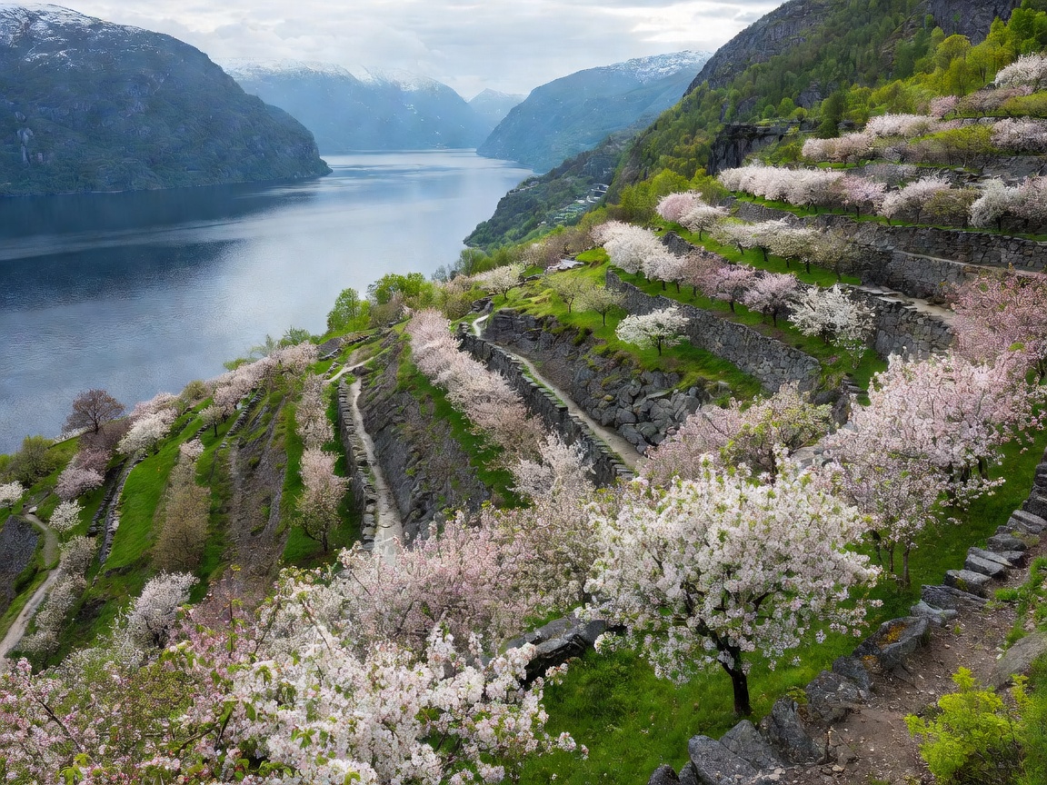
Hardangerfjord represents a captivating intersection of pastoral agricultural landscapes and stark glacial mountains. Flanked on the south by the Folgefonna ice cap and to the east by the vast alpine expanse of the Hardangervidda mountain plateau, the fjord benefits from southern exposure and thermal regulation provided by deep waters. This protects shoreline slopes from severe frosts, making the Sørfjorden arm Norway’s undisputed centre for apple, cherry, and plum cultivation.
In May and early June, thousands of blossoming apple trees mantle the hillsides between Lofthus and Ullensvang, set against snow-draped alpine summits. In recent years, local producers have revitalized artisanal cider making, turning Sørfjorden into a designated cider route accessible by regional passenger boat.
Iconic Waterfalls & Engineering Landmarks
Water flowing from the mountain plateaus creates some of the most accessible and dramatic cascades in Scandinavia:
- Vøringsfossen: Situated at the head of Måbødalen near Eidfjord, Vøringsfossen has a free drop of 145 metres (total drop 182 metres). A contemporary cantilevered step bridge spans the chasm, providing viewing platforms directly over the thundering gorge.
- Steinsdalsfossen: Near Norheimsund, this unique waterfall features a safe pathway built directly behind the sheet of cascading water, allowing visitors to walk underneath without getting wet.
- Låtefossen: In Oddadalen, this twin-channel waterfall blasts directly beneath an arched stone highway bridge, sending perpetual spray across the roadway.
- Hardanger Bridge (Hardangerbrua): One of the longest suspension bridges in the world, spanning 1,380 metres directly across the fjord mouth, complete with illuminated roundabout tunnels inside the mountain rock on both shores.
Trolltunga & Alpine Trekking
Odda and Tyssedal serve as the base camps for trekking to Trolltunga (The Troll’s Tongue), a horizontal rock shelf jutting 700 metres above Lake Ringedalsvatnet. The round-trip hike spans 27 kilometres from the primary trailhead, demanding 8 to 12 hours of endurance and serious mountain preparation. Trekkers encounter sub-alpine weather conditions that can swing from sunny skies to blizzard force winds even in mid-summer.
Comparing Fjord Highlights: Sognefjord vs Hardangerfjord
| Factor | Hardangerfjord | Sognefjord |
|---|---|---|
| Primary Character | Orchards, cider trails, dramatic single waterfalls | Sheer colossal scale, deep canyons, medieval stave churches |
| Glacial Access | Folgefonna glacier (summer ski, glacier walks) | Jostedalsbreen glacier branches (Nigardsbreen) |
| Bergen Proximity | Approx. 1.5 to 2 hours drive to outer arms | Approx. 2.5 to 3.5 hours drive to central arms |
Recommended Itinerary Sequence
A productive three-day circuit from Bergen travels east through Norheimsund, crosses the Hardanger Bridge into Eidfjord for Vøringsfossen, proceeds south along Sørfjorden past the orchards of Lofthus, and exits through Odda and the Folgefonn tunnel toward the coastal highways.